I'm a bit stymied this week because I've lost some photos I need for my blog post. I was going to tell you about a bit of local waterways history, but I can only effectively do half of it now. Let's see how I get on.
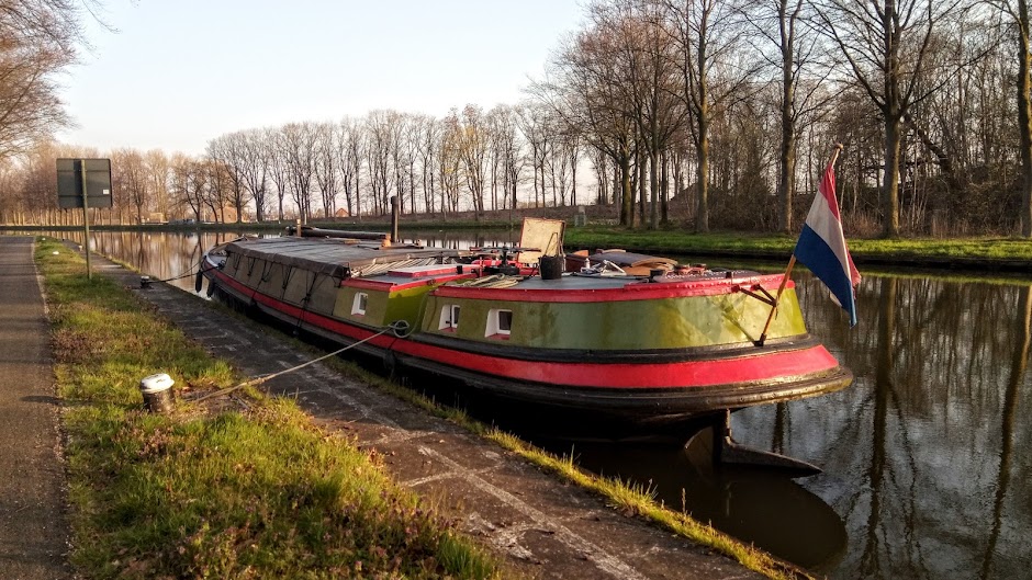
A couple of weeks ago, Koos and I were looking at Google Earth to find a weekend mooring one of our neighbours told us about and which we're interested in trying out with the Vereeniging. It's not far from Oudenbosch and is apparently a lovely quiet spot.
The screenshot below shows the Dintel (bottom left) with a little boat at the mooring. It appeals to us because there's a small bridge to the land, which you might be able to see if you enlarge the photo. However, although that's what we were initially on the satellite view to find, we were even more interested to see the small waterway leading from it to what is clearly a lock called the Keenesluis (Keene Lock).

"Shall we go and have a look at it?" I asked Koos. Ever eager to investigate waterways' history, Koos didn't hesitate.
"Yes, let's. I'll see how we get there by road," a trip that turned out to be quite a bit more circuitous than going by boat.


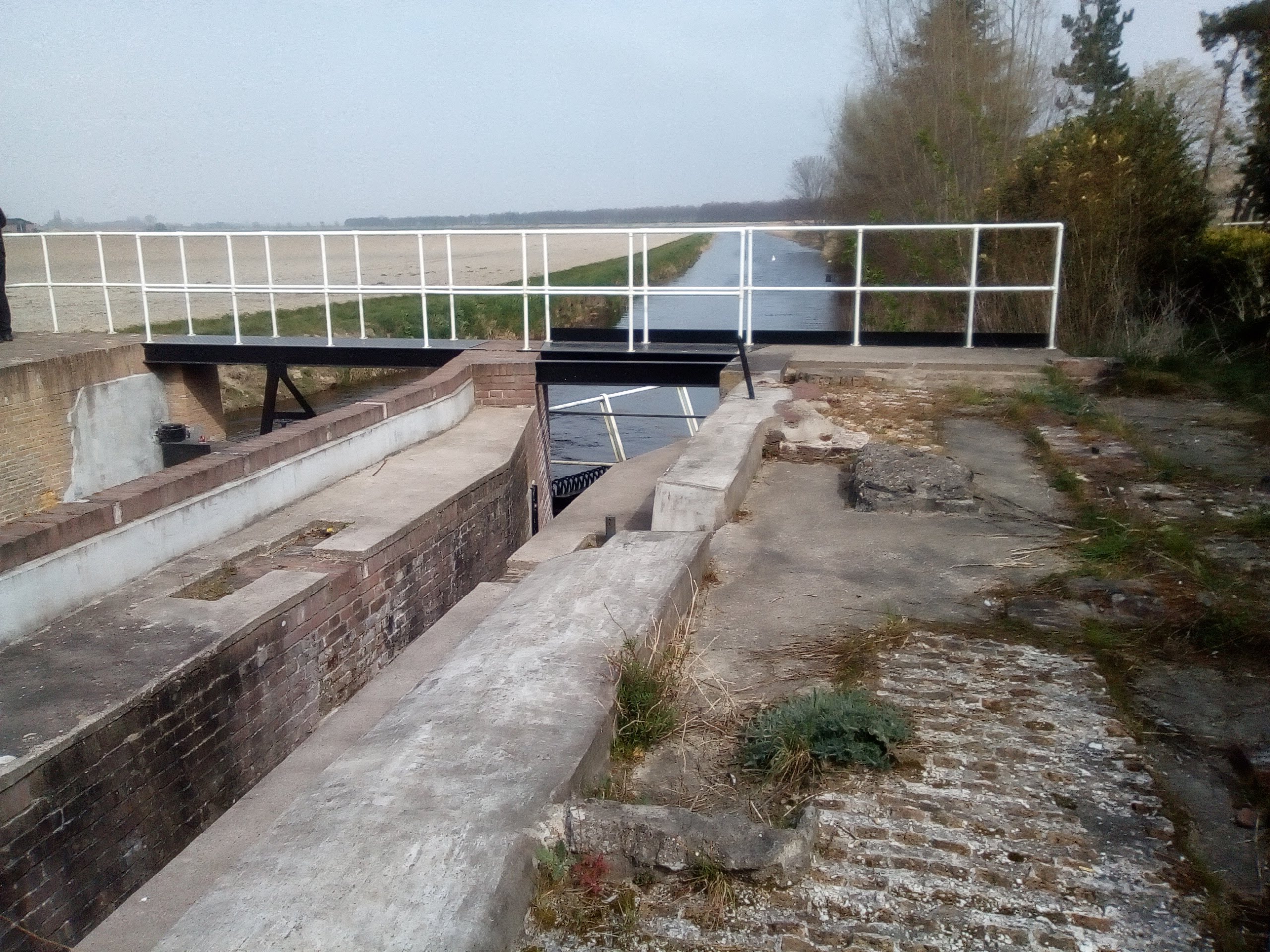
We walked all around and over it to see where the old stonework was revealed.
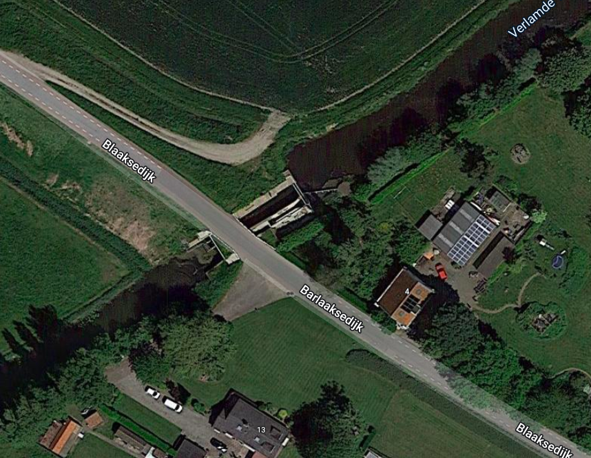
The zoomed-in screenshot above gives a better view of the lock, which we approached from the south eastern side of the Barlaaksedijk. It turned out to be a pretty drive around the edge of the village of Standdaarbuiten. I know. What a name! It's apparently derived from a phrase meaning 'beyond the border pole' but was often corrupted to 'Sand on the outside'. Here's a Wikipedia link to the village. It has a bit of WWII history attached to it, which you might also find interesting. And here's a photo of the village I found on Flickr by one Johan Bakker.

Anyway, on we drove around the lanes until we came to the spot where we knew the lock could be found.
Originally, in the 18th century, it was a stop lock to control tidal waters from the Dintel, which at that time was open to the sea. There's an interesting article about it here, but it's quite difficult to imagine how it was in those days. Unfortunately, although the lock's been restored, it isn't as it was originally when it had two sets of flood gates and two for the ebb. However, it's probably still used to control water levels because it now has new gates (see below). The original lock width appears to have been reduced.


What I found especially interesting was looking at the old map of the waterways in the vicinity. There were so many inlets and other navigable waterways before the area was dammed and drained it's virtually unrecognisable. Still, if you click on the image and peer at it closely, you can just make out Oudenbosch (Dorp van Oudenbosch) and Standdaarbuiten (Sandt ter Buijten) from the old lettering.
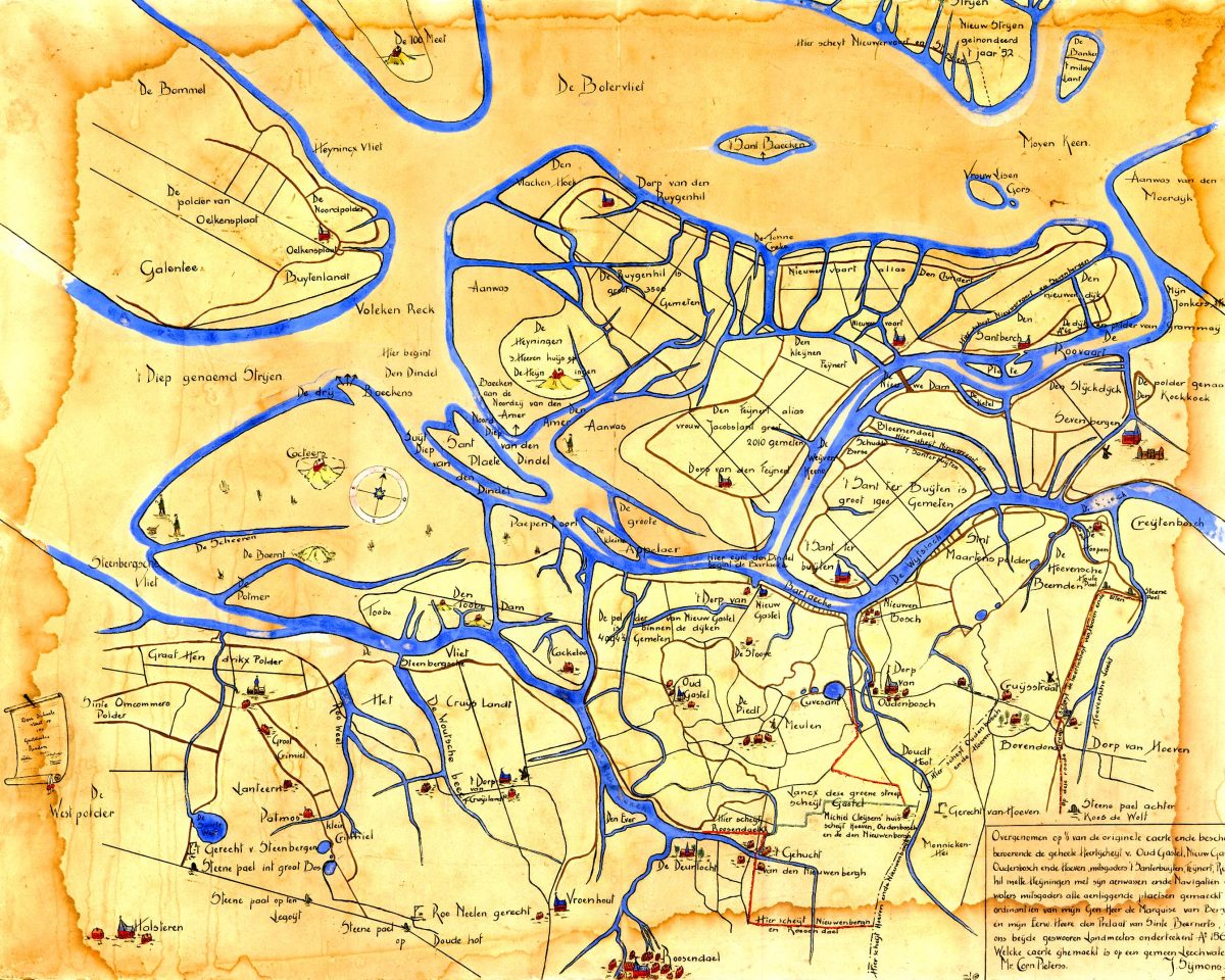 |
| Then (I'm not sure when) The blue marks the outline of the land as well as showing the waterways. See how many inlets there were  And now—more land than water. Most of the inlets have gone and the rivers are now disciplined |
So that was our fun, as it often is: pouring over maps or Google Earth, going to see what we've found and then scouring the internet for the history and information about it all.
In fact, I think I've run out of room to tell you about the park that was a harbour this time, so I can go and take more photos before next week's blog. Problem solved!
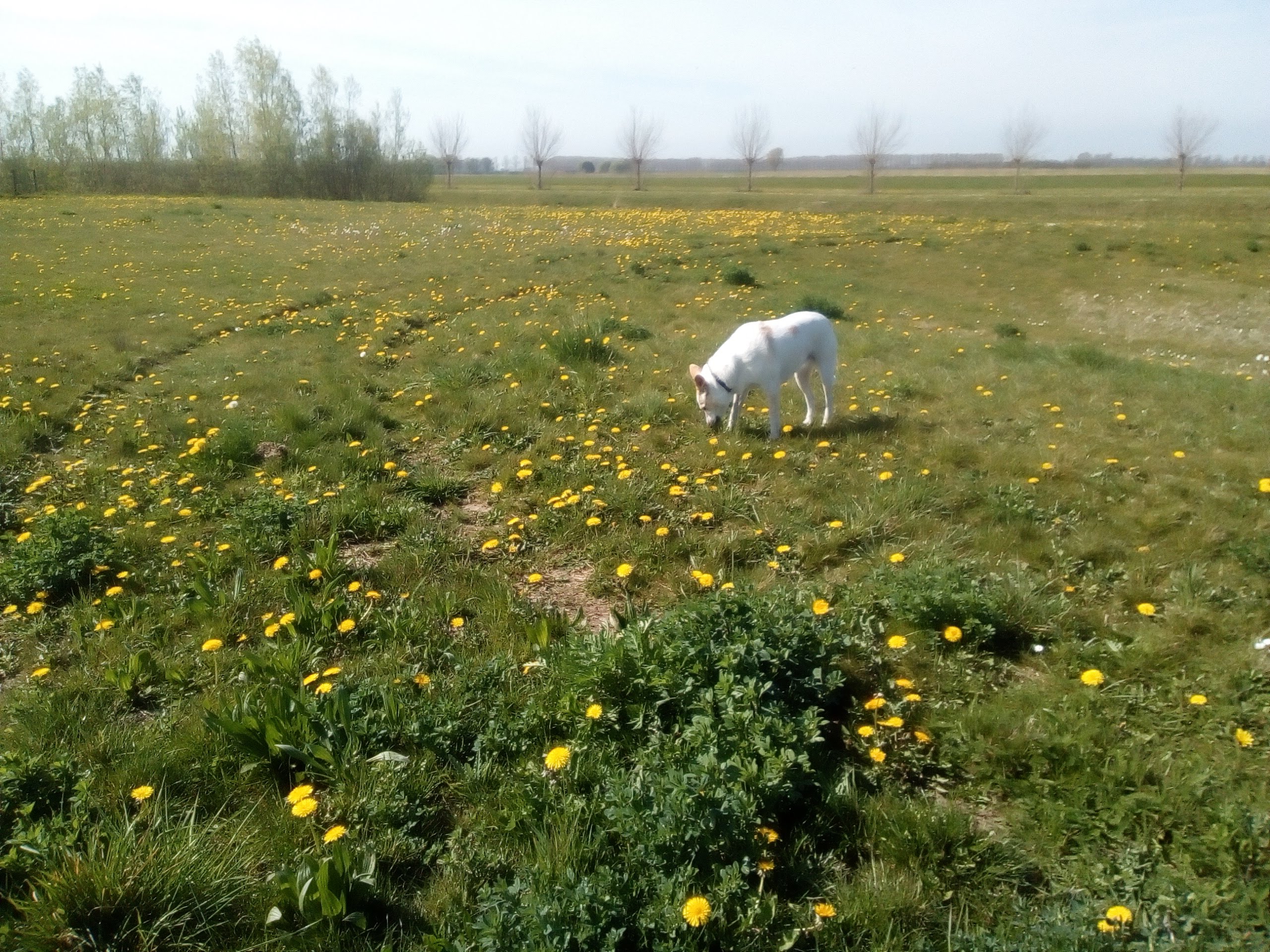
To finish up, here are a couple of photos of the spring dandelions in the meadows around us and some regulation blossom.


Have a good week, allemaal, and enjoy the April sunshine if you're here in the north. For those in southern climes, I wish you all a most wonderful golden autumn.
You two do have fun, don't you! I hereby pronounce you Lock Detectives of the First Order. Always fascinating to read of your discoveries, Val.
ReplyDeleteThank you so much, Shirley. I am so pleased you enjoy reading my about my ramblings. It makes writing these blogs so worthwhile to see your response popping up here. I do appreciate it, and thank you for the title! We shall bear it with pride :)) xx
DeleteThanks, Val! Interesting as always, and great photos. But isn't it a shame that things have to change. Sigh. (Steph)
ReplyDeleteYou're right, Steph, but in this case, it's understandable and probably a good thing as the land would have been constantly getting flooded.
DeleteIt's always very nice to read your blog posts!
ReplyDeleteAh thank you, Kathleen. I like the history of every day things as well as the bigger events.
DeleteWhat an interesting fact-finding trip, Val! Thanks so much for taking us with you. I'm not sure I'd fancy squeezing through that tunnel, there can't have been much headroom for the ag cargoes! Loved the history, and I'm looking forward to the park visit next week. Oh, and your obligatory blossom is magnificent! :D xxx
ReplyDeleteIt was quite exciting to find it, Beth. These forgotten corners always fascinate me, and you're right about the tunnel. The craft that went through there must have been quite small, even when the tunnel was full width. I'm so glad you liked the blossom!
DeleteWhat a fascinating find! Thanks for sharing it, Val.
ReplyDeleteThank you, Roger. It was indeed!
DeleteGood morning Val dear friend and thank you so much for another interesting blog around your beautiful area. Isn’t it fascinating learning previously unknown facts about our home areas. Although I knew our local town was old I have only recently discovered just HOW old! 😳😂
ReplyDeleteLorraine, it really is fascinating. Thank you so much for your comment here, my dear. I think you'll have great fun delving into the history of your town!
DeleteInteresting as ever, Val. You'd be great company round a dinner table!
ReplyDeleteAh, thank you so much, Brenda. I just love these forgotten historical corners. Sorry for the late reply, my friend. It's been a busy week. So busy, I haven't even had time for this week's blog yet!
DeleteSearching out places and doing the research can be very interesting, and time consuming. I'm currently photographing the Louth Navigation Canal from the North Sea inland to the market town of Louth.
ReplyDeleteAs ever, Wikipedia is a great source of information.
I thoroughly enjoy the research, David. Thanks! Im also interested in your blog project too, so must pop over and see if you’ve posted another one. I’ve been a bit busy lately, so my blog reading has fallen behind a bit.
Delete