Thursday, April 28, 2022

The park that used to be on a waterway

In my last post, I mentioned I'd lost some photos that would help me tell you about another of those pieces of local history I so enjoy rooting out. Luckily, I hadn't lost them at all, and found them on my tablet, which I happened to have with me when I was walking in the park mentioned in this post's title. I don't usually take photos with my tablet; actually, I don't normally carry it around with me either, but I probably didn't want to leave it in the car.

Why I was walking in the Koning Willem 1 Park in Terneuzen is easily explained, but not very interesting, so I shan't bore you with the details. Suffice to say I was doing some 'big' washing in the 'big machines at the garage, and the park was nearby which gave me the opportunity to go for a walk while I waited.

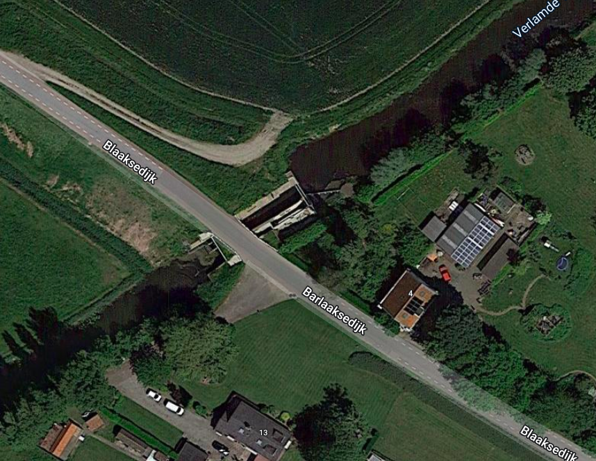
It's not the first time I've ventured into it, and I've wondered before why it was so long and narrow. I even thought it might have been a canal at one time. Well, I wasn't far wrong.

Terneuzen's history is long. It started life with the name Ter Nose and has always been associated with shipping. For centuries, it has been the entry port for ships travelling along the canal to Ghent, but it was only in the mid-19th century that it was fortified. The photo below shows the fortifications that still existed in 1955 but have now been replaced by the huge harbour that leads to the great sea locks separating the estuary from the canal. 


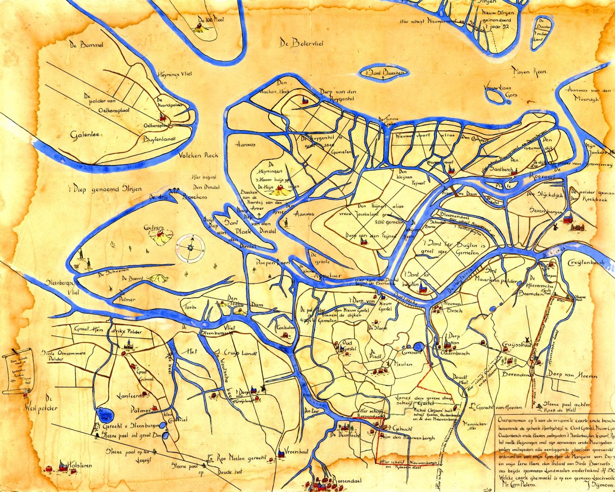
What interested me was the fact that the red dot on the maps shows where I was standing when I took my photo of these information boards. If you look at where the dot is on the 1955 map, you can see it used to be the side of a closed harbour and what the information board tells me is that it was one of the ramparts of the old fortifications.

In the second image (see below), you can see a photo of the harbour the Koning Willem 1 park replaced before the major restructuring and as always, I wish I could have seen the city as it used to be with its moated fortifications and numerous inner docks. I could just imagine standing where I was and looking into a beautiful tree-lined harbour instead of along this long, narrow park .


Today, Terneuzen's port is incredibly impressive. The sea locks are massive, and in fact, they are busy building an even bigger one now, which has resulted in the demolition of a shipyard we used to use for the Hennie H's lift out. 

The Ghent-Terneuzen Canal has been widened significantly three times, but it has had other widenings as well, and there may be more to come now the new lock is being built. What changes this will mean to the life and industry along the canal are difficult to predict, but business rules and Ghent is an important inland port.

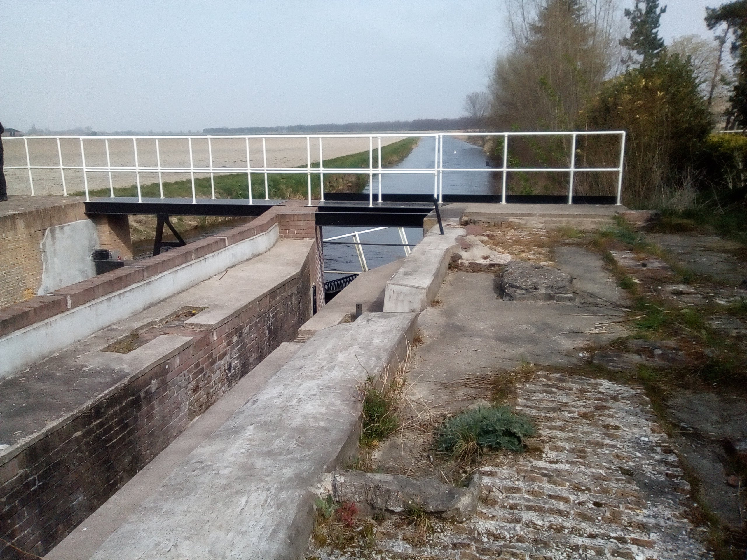
Below are some photos I took a while ago of the outer harbour where the ships enter and leave the locks when coming from (or heading to) the North Sea, the Channel and the Westerscheld estuary.


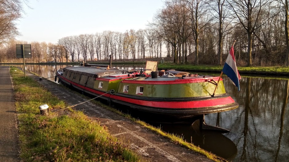
Meanwhile, we have just had our Hennie H at a shipyard along this same canal at a place called Sluiskil. She was due for her six-yearly lift out and inspection and our normal yard at Zelzate had no room for us. As a result, we mixed it with the big boys this time and spent four days on the slipway in company with a monster dumb barge, a Belgian commercial barge and another vessel whose purpose we couldn't quite make out. It looked like a pusher, but it had a catamaran hull, so it couldn't actually have pushed anything. There was also a huge sea ship in the dry dock.  

The view from the slipway was fabulous, and I took lots of photos when I should have been working. Luckily, the inspection was a breeze, the Hennie H passed with flying colours and the yard staff did the painting of the hull for us (something we normally do ourselves but weren't allowed to here), so we had a pretty easy time of it overall. 

After a short glitch this morning when the engine refused to start, Koos managed to get it going by bleeding the system, and we made our way the five kilometres back along the canal again to Sas van Gent. The starting issue will need investigation, but for now, we are glad to be back with a clean bill of Hennie H health. Below are some of the photos I took. The first was on Monday when we went up, the only cloudy day we had. Otherwise, the weather was gorgeous.


So that's it for this week allemaal. I hope you're all having a good one and that life is being kind to you wherever you are.

Monday, April 18, 2022

History revealed in a forgotten lock

I'm a bit stymied this week because I've lost some photos I need for my blog post. I was going to tell you about a bit of local waterways history, but I can only effectively do half of it now. Let's see how I get on.

A couple of weeks ago, Koos and I were looking at Google Earth to find a weekend mooring one of our neighbours told us about and which we're interested in trying out with the Vereeniging. It's not far from Oudenbosch and is apparently a lovely quiet spot.

The screenshot below shows the Dintel (bottom left) with a little boat at the mooring. It appeals to us because there's a small bridge to the land, which you might be able to see if you enlarge the photo. However, although that's what we were initially on the satellite view to find, we were even more interested to see the small waterway leading from it to what is clearly a lock called the Keenesluis (Keene Lock).


The Verlamde Vaart (formerly the Barlake to Keenehaven) is virtually closed off to the Dintel these days, but it was an operating waterway in the past and the discovery of the lock immediately grabbed us.

"Shall we go and have a look at it?" I asked Koos. Ever eager to investigate waterways' history, Koos didn't hesitate.
"Yes, let's. I'll see how we get there by road," a trip that turned out to be quite a bit more circuitous than going by boat.


The zoomed-in screenshot above gives a better view of the lock, which we approached from the south eastern side of the Barlaaksedijk. It turned out to be a pretty drive around the edge of the village of Standdaarbuiten. I know. What a name! It's apparently derived from a phrase meaning 'beyond the border pole' but was often corrupted to 'Sand on the outside'. Here's a Wikipedia link to the village. It has a bit of WWII history attached to it, which you might also find interesting. And here's a photo of the village I found on Flickr by one Johan Bakker.


Anyway, on we drove around the lanes until we came to the spot where we knew the lock could be found.

Originally, in the 18th century, it was a stop lock to control tidal waters from the Dintel, which at that time was open to the sea. There's an interesting article about it here, but it's quite difficult to imagine how it was in those days. Unfortunately, although the lock's been restored, it isn't as it was originally when it had two sets of flood gates and two for the ebb. However, it's probably still used to control water levels because it now has new gates (see below). The original lock width appears to have been reduced.


We walked all around and over it to see where the old stonework was revealed.


And when we crossed the bridge over the lock gate, we could clearly see the old archway under which boats would have had to pass when entering or leaving the lock. The article I've linked confirms the Keene was used to transport agricultural goods before the lock was built, although for how long afterwards, they don't say. Whatever the case, the Keene's mouth to the Dintel became so silted up it could no longer be used.


What I found especially interesting was looking at the old map of the waterways in the vicinity. There were so many inlets and other navigable waterways before the area was dammed and drained it's virtually unrecognisable. Still, if you click on the image and peer at it closely, you can just make out Oudenbosch (Dorp van Oudenbosch) and Standdaarbuiten (Sandt ter Buijten) from the old lettering.

Then (I'm not sure when)
The blue marks the outline of the land as well as showing
the waterways. See how many inlets there were


And now—more land than water. Most of the inlets have
gone and the rivers are now disciplined

So that was our fun, as it often is: pouring over maps or Google Earth, going to see what we've found and then scouring the internet for the history and information about it all.  

In fact, I think I've run out of room to tell you about the park that was a harbour this time, so I can go and take more photos before next week's blog. Problem solved!

To finish up, here are a couple of photos of the spring dandelions in the meadows around us and some regulation blossom.


Have a good week, allemaal, and enjoy the April sunshine if you're here in the north. For those in southern climes, I wish you all a most wonderful golden autumn.


Saturday, April 09, 2022

A return to the fold

 It seems I've missed a week here, but there was a very good reason for that. This time last week I was with my family in the UK and I have to confess blogging was the last thing on my mind. It's been three years since I've seen any of them, so it was with much eager anticipation, although slight trepidation, that I set off from the Netherlands on Wednesday, March the 28th.

Why the trepidation? Well, since March 2020 I've lived in something of an isolated bubble, only seeing my immediate family and just a few friends most of the time. My teaching has all been online, and I haven't been used to mixing with throngs of people at all, so I was a bit hesitant about being 'out there' among airport crowds and on busy trains. It seems that being a recluse comes easily to me; it's even cumulative. Not really the misanthropist I've always claimed to be, I've nevertheless had no problem with our somewhat unsocial existence for the last couple of years. 

Imagine my relief, then, when the train to Schipol airport was quiet and there were empty seats in front and behind me. I was even more grateful that the airport, one of the biggest in Europe, was also very calm and relaxed. I was very quickly through security and found I had more than two hours to wait for my flight on Sleezyjet, sorry, Easyjet. With the unusual lack of bustle, a seat in an empty row was easy to find and so I settled down to read. The flight itself was far from full, so it was a comfortable hop and a skip across the Channel and I arrived at London Luton airport forty minutes later but actually earlier than I'd left, thanks to the UK time difference.

I was even through passport control in record time, much to my sister's surprise, and since there were no restrictions or checks, I ended up having to wait for her to pick me up.  

It was lovely to be with her and her husband again. We had a really special few days; we walked, we talked, we went to her life drawing afternoon together and attended a presentation about the Glasgow School of artists. Then on Saturday, we drove to Lechlade-on-Thames to have a pub lunch with other members of the family: one of my brothers and his wife, and one of my sister's daughters and her boyfriend. It really felt like a return to the fold to see them all in such gorgeous Cotswold surroundings. The sun shone, the clouds did scudding things and the Thames was lined with narrowboats. Bliss!

Here are a few photos to give you a better image.

The Great Ouse runs past the end of my sister's garden. This
quay is almost at the head of the navigation, something I
very much wanted to see and the destination of one of our walks


Lovely clouds and sunlight as we walked back to
my sister's house

Family: the only one missing is my brother-in-law, who'd
headed home on his motorbike

The Riverside pub at Lechlade

Despite the chill, there were still boats out and about

Gorgeous narrowboats moored near the pub

The clouds were stupendous, as were the reflections

All too soon, it was Sunday and departure day. My flight was scheduled for 15.30pm, so my sister and I had time for another lovely walk along the river before she took me to the airport. From there it all went downhill. The airport was very busy, and my flight was delayed an hour. Adding that to the later arrival time because of going the other way, I didn't get back to Schipol until 18.30. Then I discovered all the trains were cancelled due to a major electrical problem. The only one that was running was the high-speed train to Brussels, which would leave me in Breda rather than at Oudenbosch station, near the Vereeniging. It's not that far from Breda (about 25kms), but I boarded the train not even knowing if I'd be able to get to Oudenbosch by public transport on a Sunday night. 

Well, my wonderful guardian angel took care of that and to my huge relief, I got on a bus at Breda station shortly after 9.15pm, which arrived in Oudenbosch at 10pm. I eventually arrived back on the Vereeniging twenty minutes later, nearly ten hours after leaving my sister's house. What a journey! Still, I was very lucky to have made it, as I left hundreds of stranded passengers sitting on the concourse at Schipol without the means to continue their journeys. The following day, the news was full of the problems people had experienced, so I've sent my guardian angel some celestial flowers for looking after me!

It was all worth it, though. The Channel isn't very wide, but it's still an undertaking to get across to see my folks. I was very grateful all the paperwork for going to and fro has been dispensed with, though. I have a feeling it might have been a lot worse if I'd had to have health declarations checked, PCR tests done, and a Passenger Locator Form to complete. Whether they've been wise in lifting all these requirements, I don't know, but it certainly made life easier. Mind you, the following day Easyjet cancelled over 100 flights due to the number of staff who were off sick, so I have my angel to thank for ensuring my return flight actually took off. I really do owe her one, don't I?

Have a good week, allemaal, and I'll be doing my blog rounds over the next few days.